An Innovation for active mobility

Environmentally-friendly monitoring system: TN Data Bike
• A diagnosis performed in real-life situation with free access to all cycle lanes.
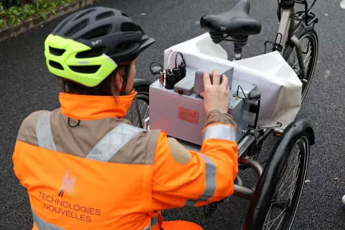
• Environment friendly equipment: auscultation system build-in an electrically assisted bicycle.
• A tool to help improve road assets in order to promote comfortable and safe cycling.
Benefits of the solution
- Collect data :
Record an image bank, the exact position of the measuring system and the user’s experience while riding - Evaluate the cycle network :
Analyse the condition of the path and its environment, qualify possible maintenance needs along with comfort and safety levels. - Advise & support :
Recommend maintenance and improvement solutions to enable users to move around easily and safely.

Better knowledge of existing cycling facilities
The advantages of TN Data Bike solution :
- High-efficiency auscultation
- Facilitates decision-making: new developments or maintenance/ modifications of cycling infrastructure.
- Optimises the maintenance budget.
- Maximum reliability and accuracy of the system:
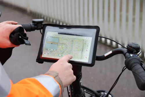
- real-time mapping display, sensor control and data acquisition quality check.
- hybrid inertial measurement unit with two GPS antennas coupled to an odometer.
Comprehensive diagnosis of track conditions
Deliverables :
1 / Records of lanes conditions, surface quality, longitudinal profile distortion and deterioration (potholes).
2 / Data analysis:
- comfort level: obstacles, slopes, parking, suitable street furniture, etc.
- Overall quality of marking and surfacing of the cycle network, visibility.
- Conformity of road equipment: horizontal and vertical signage, traffic light signals and cycle crossings.
- The environment of the cycle lane: traffic density, accident black spots.
- Focus: safety studies at intersection rights of-way (on request).
3 / Retrieval of geolocated data, publication of maps of the condition of the roadways and the ride comfort felt by the user via a link to a dynamic Open Source GIS solution and customised recommendations.

